TerrainIQby WildBone Outdoors Get the app

Hunting + off-road maps · iPhone & Android

We teach maps how to hunt.

Hunting and off-road maps that read the terrain for you.

Start free for 7 days

7 days free, then $10.99 a month or $69.99 a year. One subscription covers hunting and off-road, all 50 states.

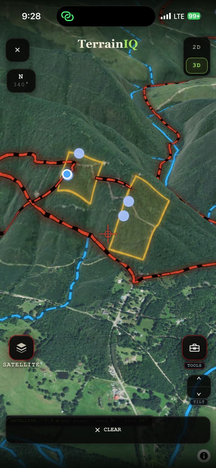
TerrainIQ in 3D over satellite, with property lines, two marked areas and creeks on the hillsides

The real app in 3D: property lines, creeks and roads on the real hills.

Two maps, one app. Pick a side.

What it reads

Three reads from real pins.

Every read below is word for word from the app.

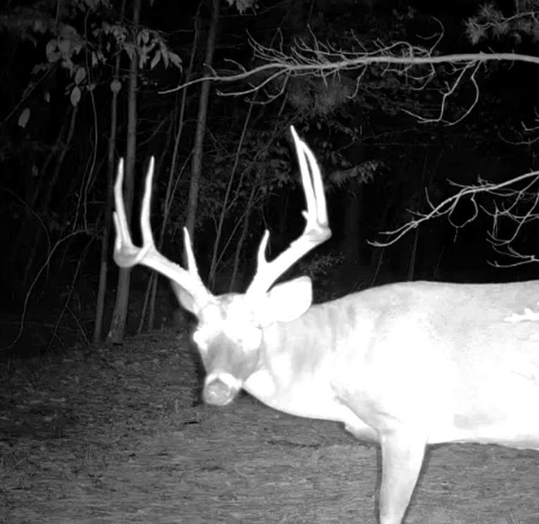
A big whitetail buck on a trail camera at night
01 · The terrain

It names the ground under your pin.

Drop a pin on a hillside. TerrainIQ measures the elevation around it and tells you what that shape is.

Ground zero · scout pinRIDGE FINGER / SPUR
"Movement leaks off the main ridge here."

Draws, saddles, benches, low spots, pinch points and water each get a plain-English read like this one.
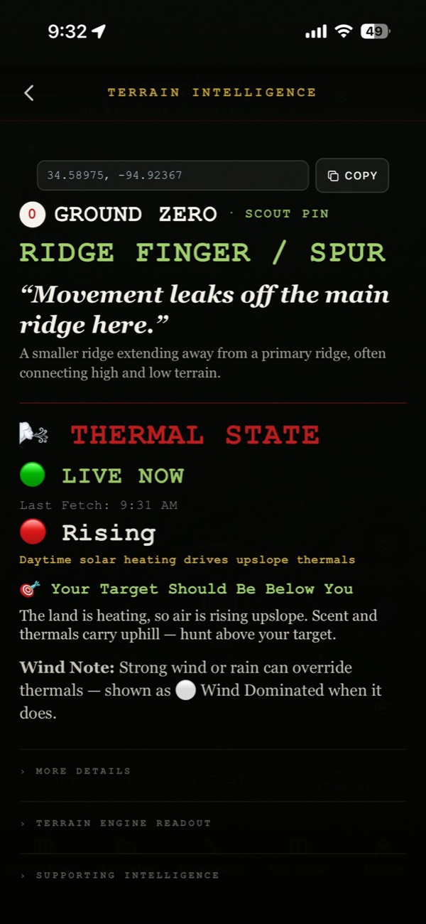
Thermal State, live now: rising. The land is heating, so air is rising upslope. Scent and thermals carry uphill, hunt above your target
02 · Wind and thermals

See where your scent may travel.

Cold air is heavy and runs downhill like water. Warm air climbs. TerrainIQ reads live wind and thermals and shows you whether they are rising, falling or turning over.

Thermal state · live now · risingThe land is heating, so air is rising upslope. Scent and thermals carry uphill — hunt above your target.
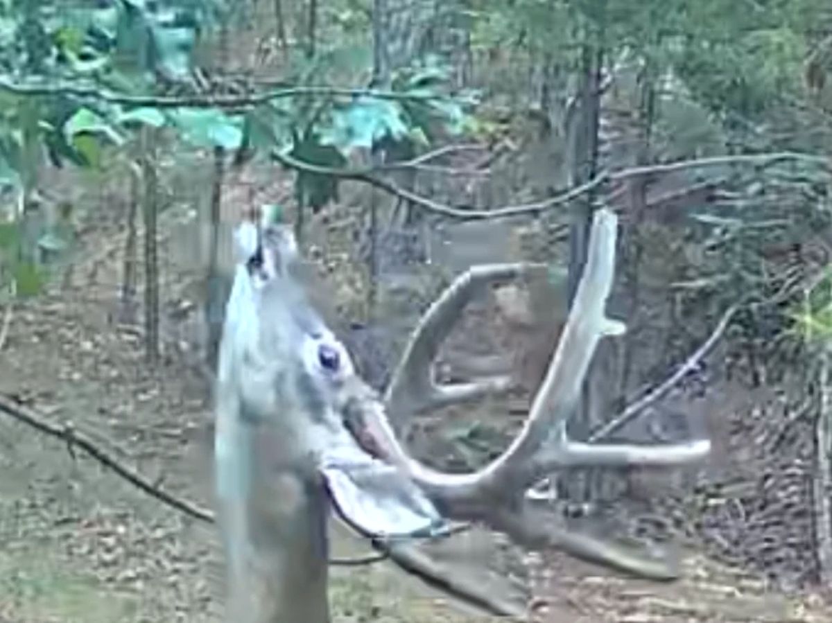
The same buck in daylight, nose up to a licking branch
Same buck. Broad daylight.
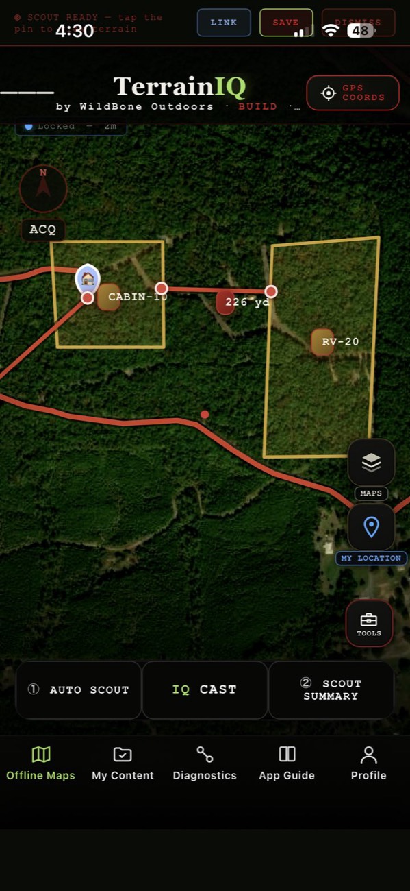
Saved offline map with two marked property areas, a cabin pin, an RV pin and a measured 226 yard line
03 · Offline

Save your maps. Use them beyond cell service.

Save your area before you leave the house. Hunting keeps the hybrid map and terrain. Off-road keeps clean aerial.

When the road ends, Point Me There gives you a compass heading and live distance back to any saved pin.

Other layers, water data and buildings need a signal.

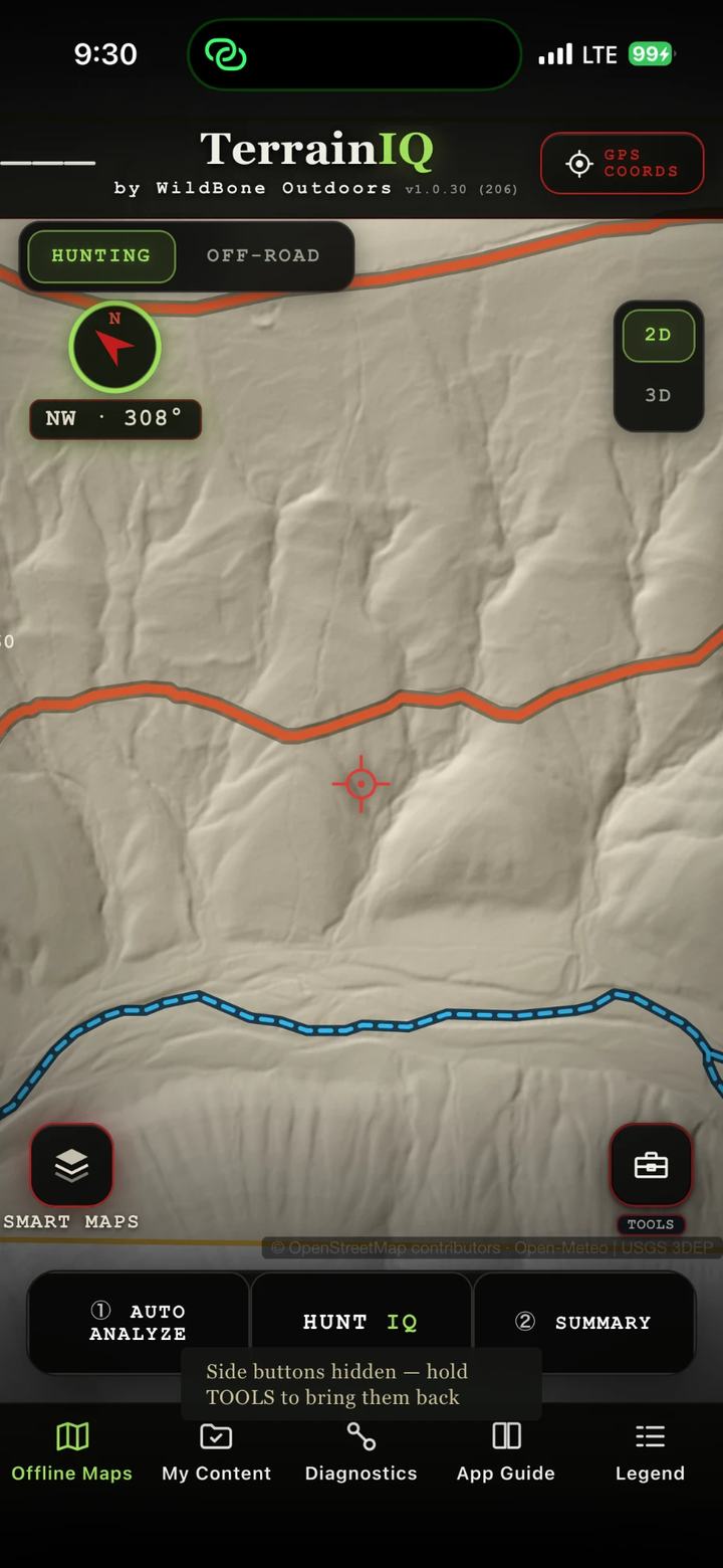
TerrainIQ LiDAR bare-earth map showing draws and benches, a road in orange and a creek in blue
Four maps, one tap apart

See the bare ground.

Satellite, LiDAR bare-earth, hybrid and topo. LiDAR strips the trees away so every draw and bench shows.

More of the app

What you will see.

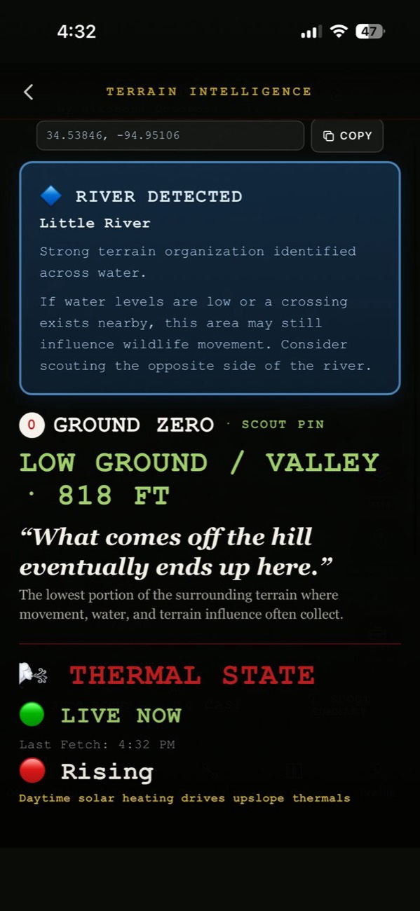
River detected: Little River. Low ground / valley at 818 feet, thermals live and rising
River detected, low ground
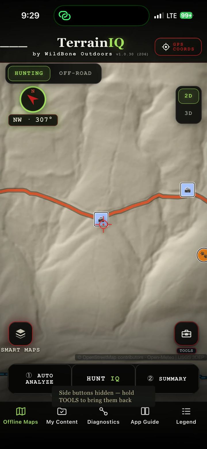
LiDAR bare-earth map with two camera pins along a road
Camera pins on LiDAR
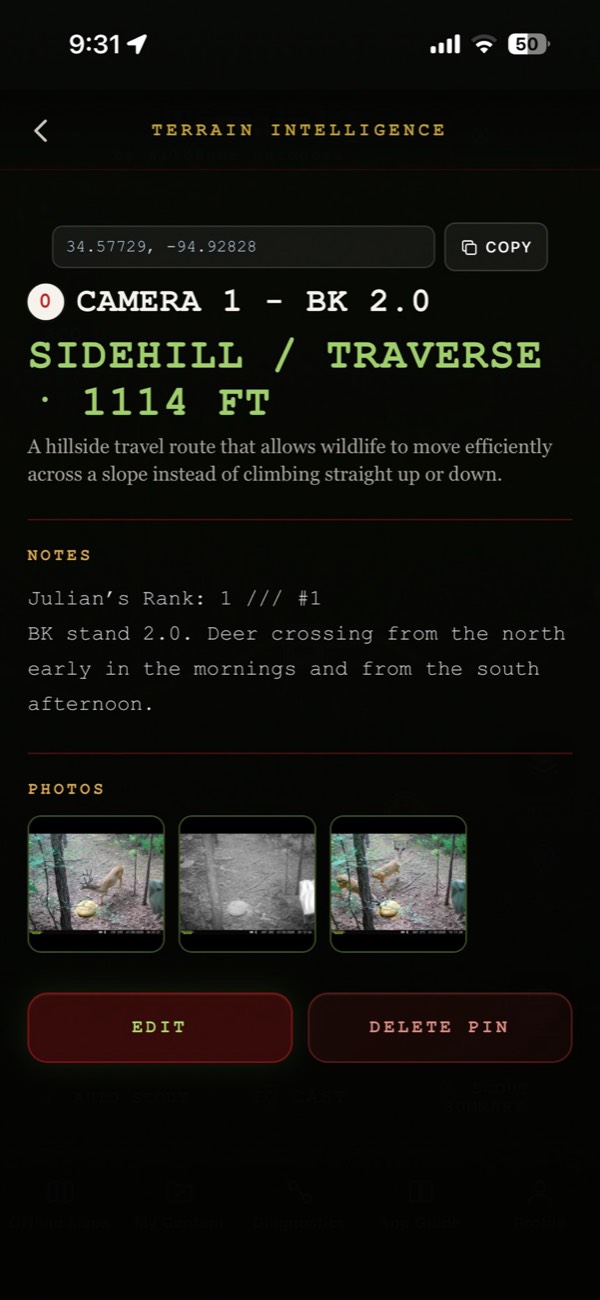
A camera pin with the owner's notes and three trail camera photos
Your camera pins, notes and photos
From the field

What hunters told us.

"I picked a random spot on my lease and it marked 2 of my existing deer stands perfectly."

Dave M. · Mt. Ida, AR

"Thermals are no longer confusing."

Kevin F. · KY

"We don't have the best service out here in the hills. The offline hybrid map is awesome."

John B. · OK

Quoted from our App Store listing.

Off-road

From pavement to pin.

Tap a road or trail to see what it is. Save an area before you leave service, and keep your maps with you.

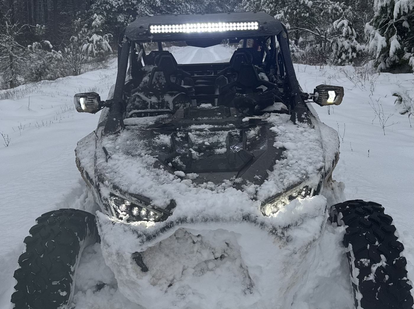
A side-by-side with its light bar on, buried nose-deep in snow on a wooded trail
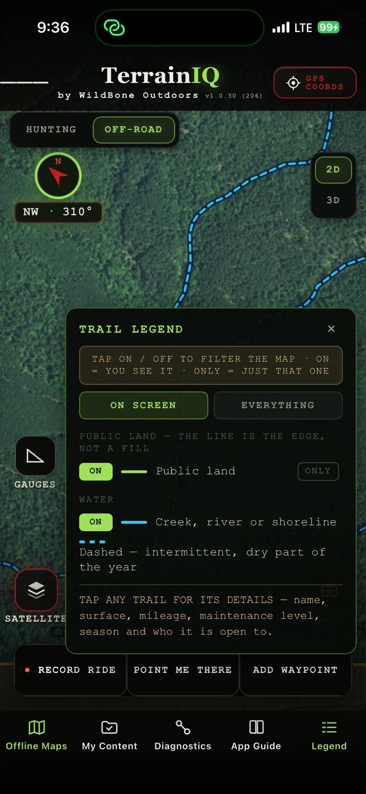
Trail legend over satellite: tap any trail for its details, name, surface, mileage, maintenance level, season and who it is open to
Trails

Tap a mapped trail.

Forest roads and trails drawn over real aerial imagery. Filter them on and off from the legend.

Trail legendTap any trail for its details — name, surface, mileage, maintenance level, season and who it is open to.
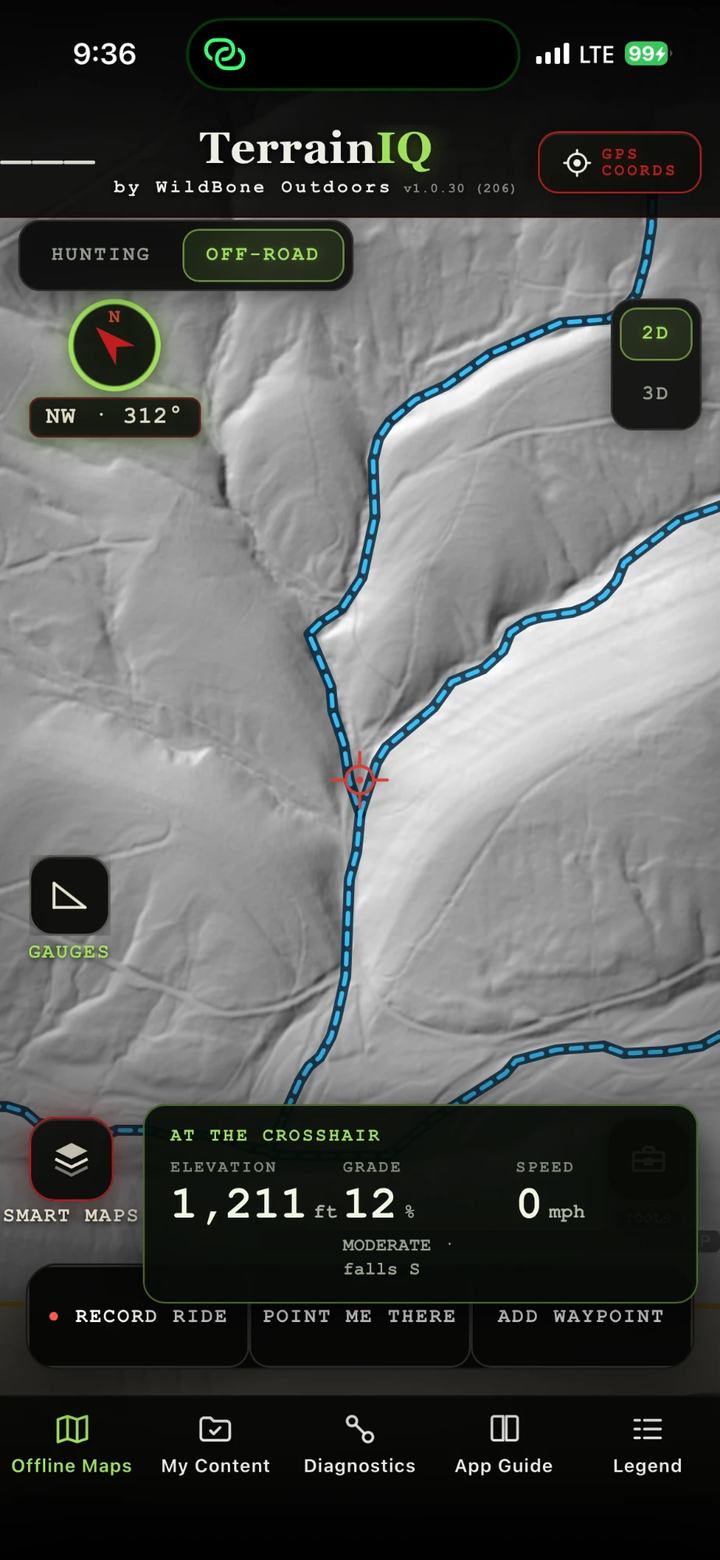
Off-road on LiDAR bare earth with the At the Crosshair gauge: elevation 1,211 feet, grade 12 percent, moderate, falls south
Gauges

Know the grade before you climb it.

Put the crosshair on the trail and read the ground under it.

At the crosshairElevation 1,211 ft · Grade 12% · Moderate, falls S
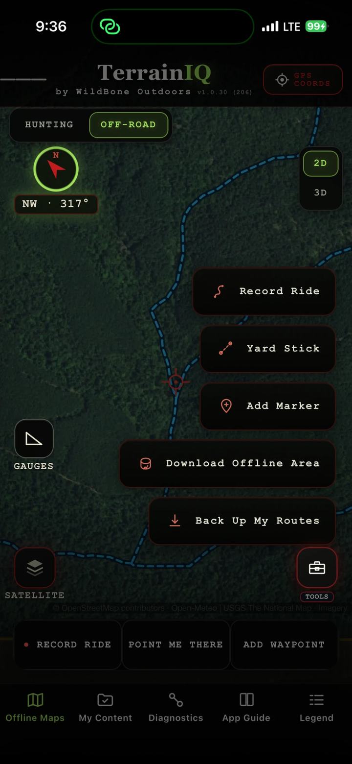
Off-road tools menu: Record Ride, Yard Stick, Add Marker, Download Offline Area, Back Up My Routes
Tools

Save it before the signal drops.

Download Offline Area while you still have service. Off-road keeps clean aerial when the bars are gone.

ToolsRecord Ride · Yard Stick · Add Marker · Download Offline Area · Back Up My Routes
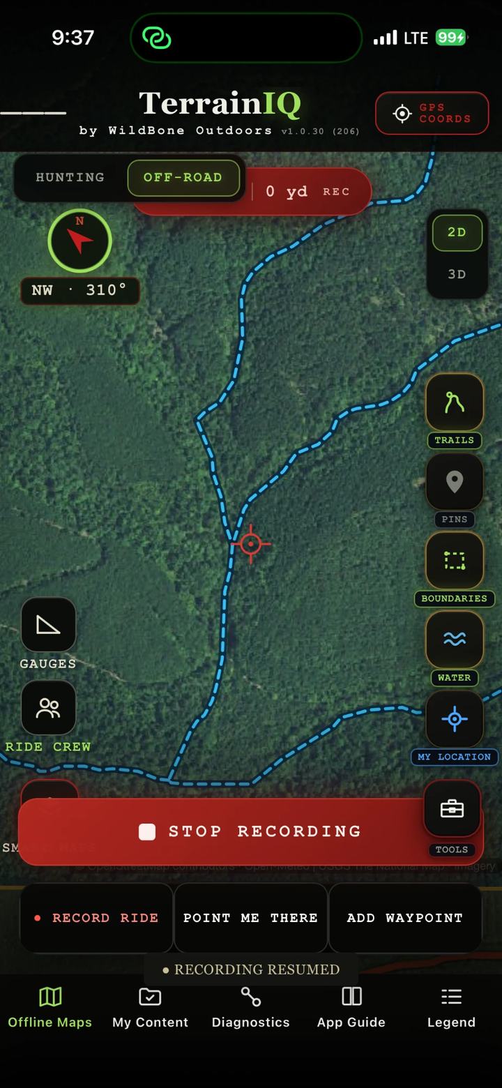
Recording a ride on the off-road map, with Stop Recording, Point Me There and Add Waypoint buttons
Ride

Record the ride.

Tap Record Ride and go. Point Me There and Add Waypoint stay one tap away.

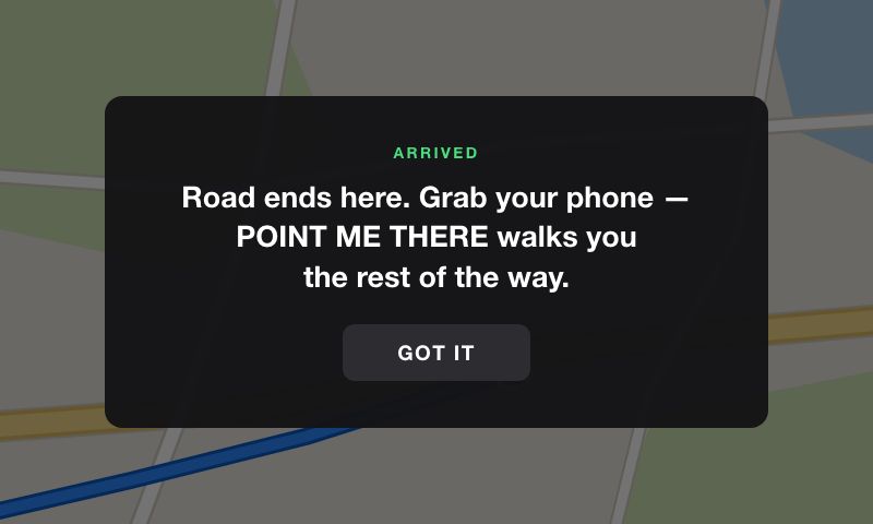
TerrainIQ on CarPlay: Arrived. Road ends here. Grab your phone, Point Me There walks you the rest of the way.
TerrainIQ on CarPlay, at the end of the road.

Tap any road

Dirt or gravel, how rough, how many miles, and whether it is open.

Directions, then the compass

Get Directions follows the road to your saved spot, then the compass takes over.

CarPlay & Android Auto

Your saved spots on the truck screen. Android Auto gives turn-by-turn to any saved pin.

Hunt the physics. Kill the guesswork.

The full app, free for 7 days. Then $10.99 a month or $69.99 a year. Cancel anytime in your App Store or Google Play account.

Meet the rest of the IQ family.